

You can find on this page the Brazil airports map to print and to download in PDF. The map of Brazil airport presents details of location and international airports of Brazil in Americas.
The Brazil airports map shows location of airports in Brazil. This airports map of Brazil will allow you to determine which airport you will used to leave or arrive in Brazil in Americas. The Brazil international airports map is downloadable in PDF, printable and free.
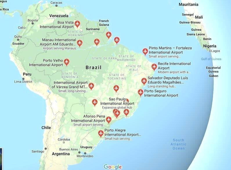
There are about 2,500 airports in Brazil, including landing fields: the second largest number in the world, after the United States. São Paulo-Guarulhos International Airport, near São Paulo as you can see in the map of Brazil airports, is the largest and busiest airport, handling the vast majority of popular and commercial traffic of the country and connecting the city with virtually all major cities across the world.
Tourists generally fly into one of two main international airports in Brazil. Sao Paulo Guarulhos International Airport is the largest gateway into the country, while Rio de Janeiro Galeao International Airport comes in a close second. These airports connect to all regions in Brazil and many other international cities across South America as its shown in the map of Brazil airports. TAM Airlines and Gol Transportes Aereos, the two most well known airlines in Brazil, operate from both of these.
Brazil is one of the most attractive destinations in the world! Its otherworldly landscapes vary from long stretches of beaches, lush rainforests and iconic sights. Brazillian culture is worldwide known for its authenticity and rhythmic atmosphere. If flying to Brazil, it is good to know that there are hundreds of airports in the country as its mentioned in the map of Brazil airports. How well developed and maintained they are shows the fact that even five of the Brazilian airports were rated among the top 50 best airports in the world.